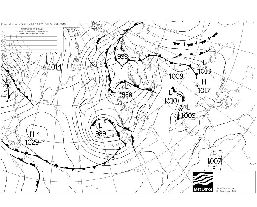
 This is an isobar chart for Europe showing the air pressure and the places that have common air pressure. It is also showing cold fronts, which are the darker lines with the triangles on them and the warm fronts which are the darker lines with the half circles on them. It also shows low pressure and high pressure cyclones. http://www.uni-koeln.de/math-nat-fak/geomet/meteo/winfos/ukmetof/tnlast_24.gif
Friday, August 8, 2008
Isobar
This is an isobar chart for Europe showing the air pressure and the places that have common air pressure. It is also showing cold fronts, which are the darker lines with the triangles on them and the warm fronts which are the darker lines with the half circles on them. It also shows low pressure and high pressure cyclones. http://www.uni-koeln.de/math-nat-fak/geomet/meteo/winfos/ukmetof/tnlast_24.gif
Subscribe to:
Post Comments (Atom)
No comments:
Post a Comment