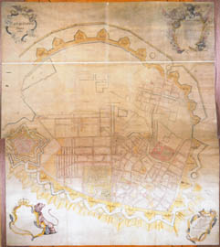
Cadastral Map: A map showing boundaries and subdivisions made to record ownership and rights in land and to describe and establish the value of property, usually for the purpose of tax assessment.
This cadastral map is from the 18th century. It shows land registers, churches, quarters and borders.http://img.kb.dk/ha/boghist/kob/kbhkort1750_1%28270h%29.jpg
No comments:
Post a Comment