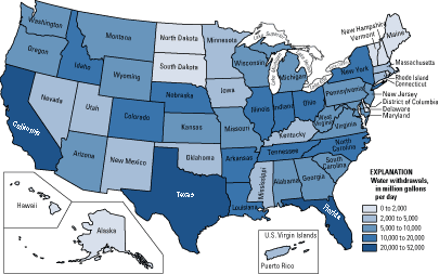
 Choropleth Map: map in which areas are shaded or patterned in proportion to the measurement of the statistical variable being displayed on the map.
This map represents the water withdrawals across the United States during the year 2000. The different shades of blue indicate the integers of amounts of water in million gallons per day.
http://pubs.usgs.gov/fs/2005/3051/images/2000choropleth.gif
No comments:
Post a Comment